Detail Itinerary
Day 01 : Kathmandu
Arrive at Kathmandu International Airport and get transferred to a hotel.
Day 02 : Kathmandu
After breakfast, proceed for a city tour of Kathmandu visiting Durbar Square, a complex of palaces, courtyard and temples, built between the 12th and 18th centuries used to be the seat of the ancient Malla kings of Kathmandu. In the afternoon visit the Swoyambunath Stupa and Patan City. Swoyambhunath Stupa, atop the hillock is one of the holiest Buddhist sites in Nepal enlisted in the World Heritage Site. Patan City is an enchanting melange of palace buildings, artistic courtyard and former palace complex. One remarkable monument here is a 16th century temple dedicated to the Hindu God Lord Krishna, built entirely of stone.
Day 3: Kathmandu-Pokhara
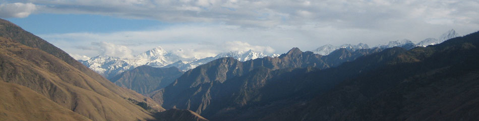
Early morning after breakfast drive or flight Pokhara.Pokhara is a place of remarkable natural beauty. The serenity of Phewa Lake and the magnificence of the Fishtail Peak rising behind it create an ambiance of peace and tranquility. Pokhara is a perfect place to see the panoramic view of Himalayan region including Annapurna and Dhaulagiri.
DAY 04 : Transfer to airport for flight to JOMSOM, trek to KAGBENI.
Though it is only a 30 minute flight from Pokhara to Jomsom, the mountain views from the plane are spectacular, with Dhaulagiri, Annapurna, Manaslu and Fishtail all clearly visible.
The airstrip is in Jomsom, the main village in the Kali Gandaki valley.
We begin our actual trek by following the course of the river – we walk in its bed, which though full in monsoon time, is now just a rivulet. Nilgiri and Dhaulagiri are visible, with their glaciers gleaming in the sun – a graphic contrast to the area of barren canyon we are walking through. Eventually the red monastery of Kagbeni, which belongs to the Sakya sect, can be seen in the distance : this is the gateway to Mustang and the kingdom's desolate lunar-like landscape is visible towards the horizon.
The name Kagbeni comes from 'kag' (boulder) and 'ben' (confluence of two rivers) and there are corn, barley and potato fields surrounding this charming village, which has two and three-storeyed houses with whitewashed walls, and flat roofs where firewood and hay is dried for winter. The houses are built very close to each other with small alleys leading to their doors, giving a maze-like impression.
DAY 05 : KAGBENI – CHELE
We start our day's trekking especially early in Mustang, because of the heavy wind which gets up later in the day, blowing dust and sand around. We can see Nilgiri glowing orange in the first rays of the sun. We take the western route, following the east bank of the river until we reach the end of a broad valley, where we cross the Kali Gandaki. After Kagbeni, the trail climbs up, giving us a good view of the village, the valley and Nilgiri. At first the path follows the river closely and later it leads eastwards to flat, dry, desert-like land. Here the scenery is amazing and very characteristic of Mustang with red sandstone pillars and rock formations with fantastic forms and colours, formed by thousands of years of erosion.
The first main village we reach, Tangbe, has red and whitewashed houses and on the other side of the river from here are caves, perched high in a vertical wall, which were habitations in previous times.
Chele appears as a small white dot at the end of the canyon. The trail towards here descends gradually to the river-bed – this area is well-known for its fossils. The wide valley ends abruptly at a vertical cliff and a bridge crosses the Kali Gandaki, which flows through a natural tunnel in the cliff. The valley narrows further north and a steep trail leads us up to Chele, which is a small town with good views towards the Himalayan ranges. Chele appears to be the last village before the huge, barren hostile heartland of Mustang opens out.
DAY 06 : CHELE – SYANGBOCHE
Today's hike begins with a steep climb as we follow the trail westwards and when we see Ghyakar on the opposite side of a deep canyon the trail turns right, following the gorge. Running high up above the path is gouged out of the rock and descends in an almost sheer drop for more than 100 metres. After about one hour we are on a pass offering a good view towards Samar, the Kali Gandaki valley and snow-capped peaks in the distance.
After Samar we cross a side-valley, descending to its base and crossing over a creek, before we trek all the way up again on the other side. About two hours from Samar is a red painted cave monastery, which looks as if it has been stuck on to the vertical wall. This is Rangchyung chorten, one of the most sacred places in Mustang. The name means 'the chorten that formed itself', because inside are two large stalagmites in a chorten-like formation. Two famous Buddhist teachers, Padmasambhava and Atisha stayed in this cave centuries ago. There are prayer flags on the ceiling and pilgrims have left small clay figures inside.
The trail goes through a forest of small trees and green bushes which are able to survive in the narrow gorge because the high vertical walls keep them cool and sufficiently moist.
Soon the valley broadens out and we can see walls built in front of caves which are temporary homes for the herders whose animals graze here. Sometimes it is possible to see the rare blue mountain sheep in this area.
The walk to Syangboche can seem never-ending..it is fairly easy, but a constant climb with the destination nowhere in sight, until, finally, a cluster of houses appears. It is much colder up here.
DAY 07 :SYANGBOCHE – GEMI
Within 15 minutes of the start of today's trek we have already negotiated the first of today's three high passes, Yanda La, and passed a distinctive red chorten painted with Buddhism's eight auspicious symbols. A terraced valley with groups of yellowish trees appears and above the village of Gelung are two red gompas. Unlike other villages in Mustang, where the houses are built close together and look fortress-like, Gelung is spread out wide on a patch of green grass and gives the impression of being a fairly affluent little community. Rising above the village are barren, brown hills and we can see the Nyi La pass straight ahead. Two beautiful chortens stand out, yet at the same time seem to harmonize with their surroundings. It is common to meet local people on foot and on horseback on this section of the trek. The scenery is vast and barren – a desolate wilderness but with a strange uncanny beauty also.
The path descends gradually towards the Gemi La pass and on the way we see a dilapidated, abandoned village downstream. By now the landscape is even more rugged – a deep riverbed has snaked its way down from the red cliffs and immediately ahead are hills which have the outline and colour of enormous sand-dunes. Another broad valley comes in from the left-hand side and in its centre is Gemi, Mustang's third largest town, which is high above the river and surrounded by fields. Gemi is eerily quiet – its crumbling dzong is disused, the gompa near the fort is closed and we can see dung spread out on the house roofs to dry in the sun so it can be used as fuel.
DAY 08 : GEMI – TSARANG
Outside Gemi we see what is Mustang's longest main wall – approximately 1000m long and decorated with simple carvings, blending in well with the surrounding scenery. There is also a group of chortens standing in front of the red wall which forms the end of the valley. Again, the architecture here is like an organic extension of nature.
According to legend when the famous Guru Rinpoche (Padmasambhava) came to the area and fought and destroyed a demon, its intestines landed at the site where the mani wall stands, its lungs near the red cliffs behind and its heart at the spot where Mustang's oldest monastery, Lo Gekar, was built.
A steady climb takes us up a 3820m pass, after which a lunar-looking desert stretches to the horizon. There is no sign of vegetation or human life here, only barren hill after barren hill with the same distinctively eerie beauty.
The first indication of human presence we see next is the Tsarang chorten – the large red-painted stupa is in the middle of the landscape and further down the monastery and the palace of Tsarang can be distinguished in the fields. A broad road leads to Tsarang, Mustang's second town, with around 1000 inhabitants.
The gompa is a massive structure on a small hill with glaciers visible behind. In former times several hundred monks lived here – now there are only about 50, but most are not residents. Though imposing from the outside, the gompa is running to ruin and many rooms are unusable. There are some fine paintings in the assembly hall, as well as thangkas and statues.
The other main landmark here is the king's palace, which too has fallen into disrepair, having not been used for half a century. The only two rooms remaining in good condition are the Gonkhang and the chapel, which has some fine statues, including 'The Three Holies', figures who played an important part in Mustang's early history, and Tibetan books. In the Gonkhang, or room of the protectors, above, is a stuffed snow leopard, some old weapons and armour and an infamous severed hand. There are three popular theories about the hand – that it was the hand of a thief (severing the right hand was the typical punishment for a second thieving offence), that a monk offered his hand as a sacrifice, and that it was cut from the architect of the dzong, to prevent him creating a similar building anywhere else !
DAY 09 / Day 10 TSARANG – LO MANTHANG Trek and REST DAY/ EXPLORATION OF LO MANTHANG
Today's trekking begins on flat terrain and the view, apart from a chorten and a few caves, is unrelieved barrenness. After crossing a pass and walking through two rocks forming a natural gate we have finally arrived at Lo Manthang.
This city was founded in about 1450 by the son of the legendary Ame Pal, who conquered and united the small kingdoms in upper Mustang. The high wall, 300m long by 150m wide, in an 'L' shape, has safeguarded the town from warriors, bandits and fierce winds for hundreds of years and archaeologists say the fact that the wall has not been extended is proof that this community has remained largely unchanged for the last 500 years.
Around 1200 people live in about 150 houses, connected by narrow alleyways. Most of the houses are two-storeyed, with the bigger buildings being monasteries or palaces.
There are some chortens in front of the main gate, and after these the first building we see is the 40' high king's palace.
There are three monasteries in Lo Manthang, but monks are only resident in the newest, Chode Lhakhang, which is about 200 years old and offers secular as well as Buddhist teachings.
The other two monasteries are no longer used, but are looked after by different families, who share the duties of changing the water each morning and lighting the butter-lamps when night falls. Many people here protect their homes from evil spirits by hanging 'ghost traps' over their doors – these are decorated goat skulls with pieces of string knotted around).
The landscape around Lo Manthang is jigsaw-like in its diversity, being composed of valleys, canyons, plains, snow-capped mountains and rivers, with the ancient city as the centerpiece.
DAY 11 :LO MANTHANG – TAMAR
We walk up through pastures studded with juniper, and have the chance to look back at Lo Manthang. Our return route is on the same side of the Kali Gandaki, because the eastern part is even less inhabited , more strenuous for walking and drinking water can be hard to find.
Gradually we say goodbye to the Lo Manthang plain (sometimes known as 'The Plain of Prayers') and after about two hours there is no sign at all that such a gem of a city is concealed in one of those rocky valleys.
In front of us the mass of the Himalayas reappears and we negotiate the highest pass, Lugri La (4200m). A small creek flows down the other side of the pass and – a welcome change – we begin to see grass, flowers and bushes. Soon the monastery of Lo Gekar, one of the oldest and most important in Mustang, appears. It was here that the first of the hidden scriptures of Padmasambhava were discovered (he hid his teachings in many different places in the Himalayas, to ensure that they were safe when the times were dangerous for the survival of Buddhism). In the anteroom of the monastery are tiles depicting Buddha Shakyamuni and Bodhisattvas. The Gonkhang is illuminated by dozens of butter-lamps, which enhance the statues, including images of Padmasambhava and the Yoginis Yeshe Tsogyal and Mandarava. In a small room to the left are more beautiful figures, including a Green Tara.
Leaving the monastery, we have a short but steep walk down the yellow canyon to Tamar, seeing fields in the southern and western part of the valley and large red vertical cliffs in the North West. After our time in such a very barren landscape with little in the way of colour contrasts, the combination of red rock, blue sky, green grass and white yaks seems very intense !
Above the village are numerous caves, but their entrances are only accessible to rock climbers. At the entrance to the canyon is an unusual looking chorten – the top looks like a bush because of the hundreds of prayer flags woven into it. Around the chorten are hundreds of erected stones.
DAY 12 : TAMAR – SYANGBOCHE
With Nilgiri visible again, we walk past more caves on our way south and then there is a gradual hill climb bringing us above Gemi, where we can see the town, the long mani wall and the pass we climbed five days ago ! There are two more passes to cross and splendid views of the Annapurna range. Next we reach Jamyung, at the fork between Gelung and Syangboche. We can detour to Gelung, with two gompas built above the village and a small but fine monastery. Later we rejoin the regular trekking path to Syangboche.
DAY 13 : SYANGBOCHE- TETANG
The direct trail to Samar runs high above the canyons and with each side valley we cross, the Annapurna range appears closer and closer. Parts of this section of the trek are quite tough-going, because of the gorges, but the compensation is the brilliant views of Tilicho and Nilgiri. As the mountains start to appear higher and higher and the vegetation increases there is also a great contrast with the walls of ice. Such subtle variations in colour after the 'moonscape' bleakness are a refreshing change. We cross two deep valleys before taking a lunch break at Samar and then the second part of the day is a relatively easy downhill walk. When Gyakar appears, the route becomes more spectacular, running high above the gorge. We can take a break in Chele and then we arrive at the riverbed of the Kali Gandaki region –and reach Chusang. Although we are on the same route we hiked along a few days earlier, it will probably feel much longer – the sense of time seems to change when trekking ! Soon we are at tethang's main wall and beautiful chorten, which has two of the auspicious symbols painted on each side.
DAY 14 : TENTANG – MUKTINATH
After an early start we have a good view of the village of Tethang, which consists of two separate settlements surrounded by high walls and from a distance looks like a large fort. The ascent to a plateau is steep and the trail here can be rather difficult to locate. There is an easy walk over a plain, after which comes about three hours of steep walking uphill, with the narrow trail getting precipitous at times, with loose black gravel. After ascending high in the valley the trail makes a right turn and the pass becomes visible above. At the pass, the mountains seem amazingly close, with Thorung, although the lowest peak, looking particularly impressive, having large glaciers clinging to its steep flanks. Tilicho is covered by snow with indented glaciers, while the summit of Annapurna further back does not actually seem as high as its 8000m +. Even Nilgiri's almost sheer north face is also covered by glaciers.
It is a moderate walk down to Muktinath, with stunning views of Dhaulagiri and Annapurna. Their summits are only 34km apart, which accounts for the tremendous depth of the Kali Gandaki valley. Getting to Muktinath involves crossing another valley, which takes some time.. this is another area where many fossils can be found.
The sporadic houses start to become more numerous as we get nearer Muktinath. There are 108 springs which have their source in or around Muktinath and bathing here is believed to bring good luck. Many people also collect the spring water in bottles to take home to relatives. Also at Muktinath is the legendary flame coming out of a rock, around which a Buddhist temple has been created.
DAY 15 : MUKTINATH – JOMSOM
As we begin the final day's hiking, Dhaulagiri glows orange and yellow in the early morning sun. Today we will take a side trip to the Bon Phuntsholing monastery in Libra, before returning to Jomsom for the flight back to Pokhara. The trail is rather sporadic. From a small hill the views of Muktinath are good and it is plain that much of the valley is used for agriculture. We soon reach the Panga Khola valley and the track follows the course of the river, but high upstream. We have to cross the river and walk downstream on the other side, which seems like a major detour but is necessitated by the steep cliffs further down.
After a steep ascent and descent we come to an area of pine forest – a surprising change of scenery ! We are high above the river again and must cross two bigger side-valleys on the way downstream. Eventually we came to some fenced-in fields and a garden with apple trees, near Lubra's village school.
The settlement of Lubra consists of about 20 houses near a bend in the river and was founded in connection with the establishment of the Bon Phuntsholing monastery in the 12th century. This is one of the very few Bon monasteries remaining in Nepal. Bon was the predominant religion in Tibet before the spread of Buddhism and is also called the fifth tradition of Tibetan Buddhism. In the monastery are pictures of four Lokapalas and Buddha Shakyamuni. Bags of masks hang from the ceiling. It is still the tradition today that the head member of Lubra's nine major families automatically becomes a priest.
After Libra, the trail leads to the Kali Gandaki and we have to leap across the river Panga a couple of times ! At the confluence of the two rivers we join the caravan of tourists going to Jomsom.
DAY 16 : Fly POKHARA and transfer to hotel
DAY 17 : Pokhara - Kathmandu
After breakfast scenic drive back to Kathmandu along the river bank & country side with the beautiful sceneries.
DAY 18 : Kathmandu
Free for adequate personal activities till departure transfer from hotel to the International.